Civil 3D Level 3/4 - For Civil Works And Land Surveying
Last updated 11/2020
MP4 | Video: h264, 1280x720 | Audio: AAC, 44.1 KHz
Language: English | Size: 6.75 GB | Duration: 10h 50m
Learn to create basic designs and linear works with Autocad Civil3D software applied to Surveying and Civil Works
What you'll learn
Participate in the design of roads and civil and topographic projects.
When conducting a topographic survey in the field, you can import the land points to Civil3D and save a lot of time in drawing.
Create land surfaces in 2 and 3 dimensions and generate calculations such as area, volume and earth movement
Build horizontal and vertical alignments that allow the design of a linear work such as roads, canals, bridges, railways, high voltage lines, among others.
Prepare professional plans to present works both in plan and in profile.
Requirements
A computer with basic requirements of Hard Disk, RAM (minimum 2GB) and Intel Processor, AMD
Autocad Civil 3D software any version
Very basic knowledge of Surveying, Civil or related
Description
Disclaimer:We have selected this course to offer it in English for its high pedagogical quality and user acceptance.The version of the software used is in Spanish, but the whole explanation of the instructor is narrated in English.---------------------------------------
Overview
Section 1: Horizontal Alignments II
Lecture 1 S1 study material
Lecture 2 Optimal adjustment alignment
Lecture 3 Alignment from objects with design standards
Lecture 4 Design rules and checks
Lecture 5 Alignment Composition Tools I
Lecture 6 Alignment Composition Tools II
Lecture 7 Creation of enlargements
Lecture 8 Creación de ensanchamientos automáticos por normas con parale.
Lecture 9 Creation and editing of cant - view of cant
Lecture 10 Insert Horizontal Alignment Labels
Section 2: Vertical Alignments II
Lecture 11 Study material S2 - Vertical Alignments II
Lecture 12 Creating a simple profile and properties
Lecture 13 Creating a simple profile with lags
Lecture 14 Editing static and dynamic profiles
Lecture 15 Creation and editing of composite profiles (Flush)
Lecture 16 Copy profile and offset (Remove)
Lecture 17 Checks and design standards in profiles
Lecture 18 Profile display style
Lecture 19 Profile shading and labels
Lecture 20 Object projection in profile display
Lecture 21 Profile view division by heights
Lecture 22 Creating multiple profile views
Lecture 23 Creating stacked profile views
Lecture 24 Adding guitars to profile viewing
Lecture 25 Profile Report Creation
Section 3: Assemblies and subassemblies II
Lecture 26 Study material s3 - Assemblies and sub-assemblies II
Lecture 27 Creation of Assemblies and Subassemblies (Review)
Lecture 28 Linear section editor
Lecture 29 Change of assembly and subassembly in a Linear Work
Lecture 30 Conditional Subassemblies
Lecture 31 Examine the conditional assemblies sections
Lecture 32 Create subassembly from polylines
Lecture 33 Subassembly composer
Section 4: Corridor or Linear Work II
Lecture 34 Study material s4 - Linear work II
Lecture 35 Creation of simple linear work (Review)
Lecture 36 Creation of a linear work with transition lane
Lecture 37 Creation of a linear divided road work
Lecture 38 View sections in linear work
Lecture 39 Edit sections of linear work
Lecture 40 Creation of linear work surfaces
Lecture 41 Creation of linear work surface contours
Lecture 42 Comparison of surfaces and linear work path
Section 5: Cross Sections II
Lecture 43 Study material s5 Sections
Lecture 44 Generate sampling lines and section view
Lecture 45 Display a linear work in several section views
Lecture 46 Visualize surfaces of a linear work in several section views
Lecture 47 Calculate work quantities
Lecture 48 Equations, splicing, checks and cant (review)
Lecture 49 Projection of objects in section view
Lecture 50 Cant display in section and report
This course is built for anyone who wants to learn how to handle the software.,Technicians, Technologists or Professionals in Surveying, Civil or related who want to improve their productivity and skill with the software.,Anyone who wants to learn to make designs of linear works and topography projects.
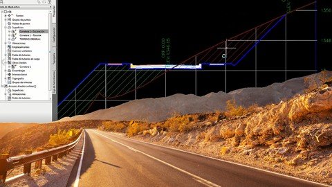
Screenshots
https://rapidgator.net/file/1c0dbbebd5cff77945796d2b987b3903/Civil_3D_Level_34_for_Civil_Works_and_Land_Surveying.part2.rar.html
https://rapidgator.net/file/7599165dccba5e451e852f3167d17296/Civil_3D_Level_34_for_Civil_Works_and_Land_Surveying.part3.rar.html
https://rapidgator.net/file/5e351aeb9cd28cac70730a5116b1d2de/Civil_3D_Level_34_for_Civil_Works_and_Land_Surveying.part4.rar.html
https://rapidgator.net/file/cf6353b02c90fd02d79499cc4067d7b1/Civil_3D_Level_34_for_Civil_Works_and_Land_Surveying.part5.rar.html
https://rapidgator.net/file/bde997b28685db04cd5a7ebe3eb2538f/Civil_3D_Level_34_for_Civil_Works_and_Land_Surveying.part6.rar.html
https://rapidgator.net/file/f8c5d7efd365f15ad18ea8130f3feedd/Civil_3D_Level_34_for_Civil_Works_and_Land_Surveying.part7.rar.html
https://uploadgig.com/file/download/d26F16e1a59BC31a/Civil_3D_Level_34_for_Civil_Works_and_Land_Surveying.part1.rar
https://uploadgig.com/file/download/c9c342A528c069e4/Civil_3D_Level_34_for_Civil_Works_and_Land_Surveying.part2.rar
https://uploadgig.com/file/download/113356a37f2465bb/Civil_3D_Level_34_for_Civil_Works_and_Land_Surveying.part3.rar
https://uploadgig.com/file/download/6792cb9e4243ea5e/Civil_3D_Level_34_for_Civil_Works_and_Land_Surveying.part4.rar
https://uploadgig.com/file/download/cbBeb358B392216c/Civil_3D_Level_34_for_Civil_Works_and_Land_Surveying.part5.rar
https://uploadgig.com/file/download/72E5Bb447f3a19b1/Civil_3D_Level_34_for_Civil_Works_and_Land_Surveying.part6.rar
https://uploadgig.com/file/download/f8d389eFF692c47d/Civil_3D_Level_34_for_Civil_Works_and_Land_Surveying.part7.rar